
Buying commercial property often looks simple on paper. The parcel has a legal description, a recorded deed, and clear boundaries. Yet many problems stay hidden until a project moves forward. An ALTA Survey helps uncover those issues before they create delays, disputes, or unexpected costs.
Unlike many other survey types, an ALTA Survey combines field observations with title research. This approach provides a deeper look at a property’s legal and physical conditions. For buyers, lenders, attorneys, and developers, that extra information can make a major difference when evaluating a commercial property.
What Makes an ALTA Survey Different?
Many surveys focus on a single purpose.
A boundary survey establishes property lines. A topographic survey maps elevations and surface features. A construction survey helps place improvements in the correct location.
An ALTA Survey brings several types of information together into one document. Surveyors compare field evidence with title records, recorded easements, access documents, and other property information. This process helps identify conditions that may affect ownership, financing, development plans, or future land use.
Because commercial properties often involve larger investments, buyers usually need more than a simple boundary map. They need a clearer picture of what they are actually purchasing.
How Does an ALTA Survey Identify Easements?
An ALTA Survey shows recorded easements and where they affect a property.
An easement gives another party certain rights to use part of the land. Utility companies may have easements for underground lines, drainage facilities, or electrical infrastructure. Some easements allow access across private property.
These rights can limit where future buildings, parking areas, or other improvements can be placed.
For example, a vacant lot may appear ready for development. However, an easement running through the middle of the parcel could reduce the usable building area. Discovering that condition before design work begins can prevent costly changes later.
Can an ALTA Survey Reveal Access Problems?
Yes. Legal access remains one of the most important issues for any commercial property.
A site may connect to a road physically, yet questions may still exist about legal access rights. In some cases, recorded documents grant access through neighboring property. In others, documents may conflict with existing conditions on the ground.
An ALTA Survey helps verify whether access rights match available records and visible site conditions.
Without reliable access, a property may face challenges during financing, development, or future resale. For that reason, access review remains a key part of many ALTA Surveys.
Why Encroachments Matter
Encroachments occur when a structure crosses a property line.
These situations often involve fences, retaining walls, parking areas, signs, or other improvements. Some encroachments remain unnoticed for years. Others become major concerns during a property transaction.
An ALTA Survey helps identify these issues by comparing the location of improvements with established property boundaries.
Even a small encroachment can create legal questions. Resolving those questions before closing helps avoid future disputes between neighboring property owners.
What Happens When Property Records Do Not Match?
Property records sometimes contain inconsistencies.
Legal descriptions may change over time. Older deeds may reference monuments that no longer exist. Different surveys may rely on different information sources.
These situations can create gaps or overlaps between parcels.
A gap refers to land that may not clearly belong to any property owner. An overlap occurs when two parties appear to claim the same area.
An ALTA Survey helps identify these conditions by comparing record information with field evidence. This review gives buyers a better understanding of potential title concerns before completing a transaction.
How Site Improvements Affect Property Decisions
Commercial properties often contain valuable improvements such as buildings, parking lots, fences, lighting systems, utility structures, and signs.
An ALTA Survey documents these features and shows how they relate to property lines, easements, and setback requirements.
This information helps property owners understand whether improvements fit within legal property limits. It also helps lenders evaluate conditions that may affect the property’s value or future use.
A building located too close to a boundary line may create complications that deserve further review.
Why Title Information Alone Is Not Enough
Title commitments provide important information about ownership and recorded property matters.
Still, documents cannot always show what exists on the ground.
An ALTA Survey serves as a bridge between recorded records and actual site conditions. Surveyors compare title information with physical evidence collected during fieldwork.
This process can reveal differences between documents and reality.
A recorded easement may appear in title documents but remain difficult to identify without a survey. Likewise, visible site conditions may raise questions that deserve additional title review.
Together, title research and survey information provide a stronger understanding of the property.
What Utility Features Can an ALTA Survey Show?
Utility infrastructure plays an important role in commercial development.
An ALTA Survey can identify visible utility features such as manholes, valves, utility poles, meters, drainage structures, and related improvements.
Knowing where these features exist helps property owners and project teams understand site limitations early in the planning process.
In some cases, utility locations may influence building placement, parking layouts, or future expansion plans.
Having this information before development begins often leads to better project decisions.
Why Commercial Buyers Depend on ALTA Surveys
Commercial real estate transactions involve significant financial commitments. Small issues can become expensive issues if they remain undiscovered.
An ALTA Survey provides information that many other surveys do not collect in a single report. It combines property boundaries, title-related matters, easements, access information, improvements, utility features, and field observations into a more complete picture of the site.
A property may appear straightforward during an initial review. Then the survey reveals an easement, access concern, encroachment, or title conflict that changes the conversation.
That deeper level of understanding explains why ALTA Surveys remain a standard part of many commercial real estate transactions. They help uncover conditions that could affect ownership, development, financing, and future property use long before those issues become costly surprises.
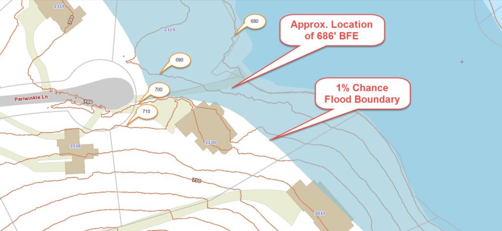 FEMA’s